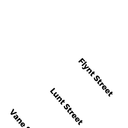
9-11 FLYNT ST
Owner Information
LAI MAY CHE
9-11 FLYNT ST
QUINCY, MA 02171


Property Details
9-11 FLYNT ST is classified as a Two-Family Residential (2 fam conver).
The primary structure on this property was built in 1920. There are 4,662ft2 of built area within this property. There is 2,834ft2 of residential/living space within this property. This property is listed as having 9 rooms.
9-11 FLYNT ST is valued at $722,500. The land is valued at $257,600 and the structures are valued at $464,300. There is an additional valuation of $600 on this property.
This property is in Zone RES B. Confirm with local Zoning Board authorities to ensure there are no overlays or other easements on this property.
The most recent deed for 9-11 FLYNT ST is recorded at the local registrar in Book 32519, Page 0073. 9-11 FLYNT ST was last sold on Friday, August 29, 2014 for $688,000.
Assessment data from fiscal year 2020.
Flood Data
According to the FEMA National Flood Hazard Layer, this property does not appear to be in a flood zone. It may also be in an area not yet reviewed. Nonetheless, confirm this information prior to taking any action.
To view the flood hazards around this property, create a FEMA "Firmette" Map of the area around 9-11 FLYNT ST.
Broadband Internet Providers
| Provider | Type | Bandwidth (mbps) | |
|---|---|---|---|
| Verizon New England Inc. | DSL | 7 | 0 |
| Viasat Inc | Satellite | 100 | 3 |
| HughesNet | Satellite | 25 | 3 |
| VSAT Systems, LLC. | Satellite | 2 | 1 |
| GCI Communication Corp. | Satellite | 0 | 0 |
| Starry, Inc. | Fixed Wireless | 200 | 200 |
| Comcast | Cable | 1000 | 35 |
Broadband service provider data from December 2020.
Adjacent Properties
- 97 BILLINGS RD
Three-Family Residential owned by 99 BILLINGS ROAD LLC - 7 FLYNT ST
Single Family Residential owned by LIN TING & XIAOLING LIN - 13-15 FLYNT ST
Two-Family Residential owned by WONG WING KEUNG - 12 LUNT ST
Single Family Residential owned by CLEARY AGNES R TREE - 16 LUNT ST
Single Family Residential owned by NGUYEN NGOC NGA T